Heritage Conservation Area, Pymble, NSW
and Federation Heritage in Pymble
Table of Contents
- See also pages Abyia, Pymble Queen Anne, Alister Brae, Pymble, Carinya, Pymble
- See also pages Telegraph Road, Pymble, Mona Vale Road, Pymble, Church Street, Pymble
 |  | |
| Heritage-listed Sacred Heart Presbytery | 'Abyia', 23 Church Street Pymble, sold byJacque and Oliver Yates for about $4 million. | First Pymble Post Office 1890 |
 |
| Pymble Conservation Area, Eastern side |
The Pymble Urban Conservation Precinct consists of an area of single-storey and double storey (1930s and 1940s) houses.
The uniform appearance of the area stems from its well-established landscape.
- The centrepiece is the housing surrounding Robert Pymble Park. the houses and park constitute an excellent example of good civic design.
- There are also excellent examples of individual houses of merit, includingCoppins, the Walter Burley Griffin designed house on the corner of Telegraph Road and Graham Avenue.
- Housing in the area consists predominantly of houses on medium- to large-sized lots. There are a few unsympathetic alterations or intrusions into the area..
The Pymble Precinct epitomises the area and era in both the excellent, intact nature of its houses, their gardens and street plantings.
- Many of the earlier Pymble houses on large lots are within this Conservation area (HCA 17), and are heritage listed, particularly
- along Telegraph Road,
- Mona Vale Road, and
- Church Street, Pymble.
The grand houses in Church Street, from 19 to 33, all heritage listed with one exception (No. 25-27), form a particularly significant group: - State Heritage Registered :
Telegraph Road, Pymble: 4, 24-26, 38, 40; 15, 17, 21, 23-29, 31, 37, 43, 51, 53, 63, 77 - see Telegraph Road, Pymble]
**Mona Vale Road**, **Pymble**: 42, 67, 71, 101, 24, 98, 97; Juniper Green, 100 Mona Vale Road; Robyn Hill, 111 Mona Vale Road - 10, 19, 21, 23, 29, 33 Church Street, Pymble
The Pymble Urban Conservation Precinct is important because:
- The area possesses streetscape integrity due to the
St Swithun's Anglican Church, on Telegraph Road, was built circa 1938
established nature
of the well landscaped gardens and street planting. - The area has a uniformity of housing style including colour, form and architectural detail that gives the area an harmonious appearance.
- The predominance of the 1930s and 1940s housing styles illustrates the important influence of British housing ideals and styles on Australia and the excellent examples of two-storey 1930s and 1940s houses illustrates the increasing affluence and expectations of the middle class.
- It reflects the availability of finance enabling the middle class to borrow money and finance the purchase of a house and epitomises the great diversion of funds in Australia from private investment in industry and infrastructure to non-productive investment in private housing.
Significant Pymble houses include:
- Grandview is a two-storey, Georgian structure made of sandstone. It was built circa 1870 as a bank but is now used as a home. It has a federal heritage listing.[9]Grandview has reverted to private use and is on the Register of the National Estate.
- Merrivale is a local stately home in the Regency style and is considered one of the finest examples of its kind in Ku-ring-gai. It has a state heritage listing.[5][10]

Coppins, Telegraph Road Pymble 
Macquarie Cottage, 11 Avon Road, Pymble - Coppins, sometimes known as the Eric Pratten house, was designed by Walter Burley Griffin and built circa 1936. It is one of three large houses designed by Griffin in Ku-ring-gai and is significant because most of his residential buildings were single-storey. It is an example of the Art Deco/Prairie style and has a State Heritage listing.[5][11]
- Macquarie Cottage, in Avon Road, was designed by William Hardy Wilson and built in 1918.
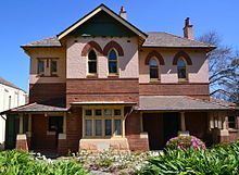
It is considered a typical example of Wilson's work and has both State and Federal heritage listings.[12][13]Colinroobie, 1 Clydesdale Place Pymble NSW 2073 - Sacred Heart Presbytery is a two-storey house in the FederationArts and Crafts style, with Gothictouches to the windows. It was built in 1907 and has a State Heritage listing.[14]
- Colinroobie, a two-storey Federation mansion built in the early 20th Century, situated at the corner of thePacific Highway and Clydesdale Place. It has a State Heritage listing.[15]
Featured on page: Federation Beauties
Federation Heritage also Featured on other pages:
- Carinya, 37 Telegraph Road, Pymble
- Alister Brae, 24 King Edward Street, Pymble
- Colinroobie, 1202 Pacific Highway, Pymble
|
|
Lanosa, 62-64 Mona Vale Rd, Pymble
"Heritage enthusiasts have celebrated an interim heritage order placed on one of Pymble’s oldest home with a connection to the controversial opening of the Sydney Harbour Bridge."- "The intact Queen Anne or federation-style home and landscaped gardens named Lanosa at 62-64 Mona Vale Rd, was built in 1897 for Charles Martin Buck, one of Pymble’s forefathers and president of the Progress of Pymble Association.
- "It is perhaps most noted for its connection to an incident at the official opening ceremony of the Sydney Harbour Bridge in 1934."
|
| ||||
| |||||
- Lanosa was the home of Captain Francis De Groot, member of the New Guard, who rode up and cut the ribbon to open the Sydney Harbour Bridge before the official opening could take place.
- Lanosa, 1920. The original face brick facades with contrasting brick details are evident. A small porch/ verandah is visible at the junction of the two wings of the building. A chimney is also visible extending above the northern side of the rear wing.
- Above from the Daily Telegraph; July 1, 2014 1:15pm Danielle Nicastri - North Shore Times
Federation Style and other Heritage in Pymble:
1. Telegraph Road, Pymble

- Go to page Telegraph Road, Pymble for a complete list of heritage properties on Telegraph Road, Pymble
Open for Inspection (October 2015) - Sandon, 31 Telegraph Road Pymble, &
- Redriff, 53 Telegraph Road Pymble
- (both by appointment, $$$, both State Heritage listed in a street of over 15 Heritage listed properties)
2. Mona Vale Road, Pymble
- See page Mona Vale Road, Pymble

3. Church Street, Pymble
Subdivisions leading up to 1890 anticipated the completion of the North Shore Railway line in 1890.- The first subdivision of McKeown’s lands, the Roseville Estate, created Roseville Avenue (now Wellesley Road), which extended north from Lane Cove Road to Church Street.
- A second subdivision created residential lots through to Stoney Creek Road (Mona Vale Road) and from Church Street to a newly defined Hope Street.
- The grand houses in Church Street, from 19 to 33, all heritage listed with one exception (No. 25-27), form a particularly significant group.
- The north-western end of Church Street, and the southern side of Church Street between King Edward Street and Wellesley Road contains a significant grouping of heritage items and potential heritage items, and forms a logical extension to the gazetted Pymble Heights HCA.
| |||||
|
|
- See page Church Street, Pymble
4. Grandview Road, Pymble
| Everleigh | 27 Grandview Street, PymbleHistorical period: 1901-1920
| ||
| Dwelling | 29 Grandview Street, PymbleHistorical period: 1901-1920
| ||
| Ku-ring-gai | 35 Grandview Street, PymbleAltered or extended unsympathetically; Historical period: Pre-1900. | ||
| Dwelling | 39 Grandview Street, PymbleHistorical period: 1901-1920; **Sold for $2,350,000** in Feb 2015'1896 Victorian masterpiece'
| ||
| Dwelling | 41 Grandview Street, Pymble (1897)Historical period: 1901-1920; Altered or extended unsympathetically;Sold for $2,770,000 in 26 Mar 2015 (Auction)
| ||
| Pymble Railway Station Group | Grandview Street Pymble railway station has aesthetic significance at a local level as a good example of a standard design station building in its original context, dating from the 1909 duplication works.  | ||
| Dahinda | 43 Grandview Street, PymbleHistorical period: 1901-1920
| ||
| Willendon | 45 Grandview Street, PymbleHistorical period: 1901-1920
| ||
Post Office | 75 Grandview Street Pymble |
5. Livingstone Avenue, Pymble
| Dwelling | 66 Livingstone Avenue, Pymble
| ||
| Dwelling | 75 Livingstone Avenue, PymbleSince subdividedReasons for listing; cultural, municipal significance Note: fine garden | ||
| Dwelling | 78 Livingstone Avenue, PymbleHistorical period: 1901-1920; Altered or extended unsympathetically | ||
| Dwelling | 80 Livingstone Avenue, PymbleHistorical period: 1901-1920; Sold on 12 Apr 2013 for $2,395,000
| ||
| Hamilton Park | 104 Livingstone Avenue, PymbleRecent price $3.3m;Sold for $1,600,000 in Dec 2007; Sold for $3,150,000 in Mar 2008; |
6. Pacific Highway, Pymble
| Pymble Pacific Highway Cottages Group | 877,881,1002,1006,1010,1022,1028 Pacific Highway, Pymble
| ||||
| Pymble Police Station | 1116 Pacific Highway, Pymble | ||||
| Dwelling | 1161 Pacific Highway, PymbleHistorical period: 1921-1940. Spanish Mission style
| ||||
| Dwelling | 1163 Pacific Highway, PymbleHistorical period: 1921-1940; Spanish Mission style**Sold for $916,000** in Mar 2013 | ||||
| Grandview | 1178 Pacific Highway, Pymble"Grandview" - two storey stone residence on Pymble Hill stands on land which was originally part of a 100 acre grant to William Wright made in 1821.
This dignified and high quality stone building is a key element in the streetscape of Pymble Hill.
| ||||
| Sacred Heart Presbytery | 1188 Pacific Highway, PymbleOn June 9th, 1907, the Sacred Heart Roman Catholic Church Presbytery foundation stone was laid by Cardinal Moran and the Presbytery opened later that year.
 | ||||
| Item | 1190 Pacific Highway, PymbleHistorical period: 1901-1920; Altered or extended sympathetically
| ||||
| Colinroobie | 1202 Pacific Highway, Pymble
| ||||
| Mountview | 1228 Pacific Highway, PymbleHistorical period: 1901-1920; Altered or extended unsympathetically |
7. Station Street, Pymble
| Maples, The | 5 Station Street, Pymble
| ||
| Chescombe | 11 Station Street, Pymble
| ||
| Llanberri | 13 Station Street, (11A Station Street) | ||
| Shadowood | 17 Station Street, Pymble | ||
| Dwelling | 19 Station Street, Pymble
| ||
| Uplands | 21 Station Street, Pymble
|
History
Pymble is named after Robert Pymble (1776–1861), an influential early settler whose 1823 land grant comprised some 600 acres, around half the land of the region.
- The other half (plus a large part of St Ives) was granted to Daniel der Matthew's, another influential settler who established the first sawmill in the area.
- The region was important to the early Sydney colony as a major supplier of timber for a wide variety of uses. The main timber varieties were blackbutt, stringybark, iron bark and blue gum.
This area lies within two early land grants,
- Robert Pymble’s 600 acre grant (240ha) of 1823 and Rosedale,
- DD Mathew’s 800 acre grant (320ha) of 1838.
These two grants extended from Lane Cove Road (now the Pacific Highway) northwards.
- Pymble’s grant extends to what is now Allara Avenue, North Turramurra, and is bounded by Station Street and Merrivale Road to the east and the alignment of Fairlawn Avenue to the west.
- Mathew’s grant extended to what is now Killeaton Street, St Ives, to the north and was bounded by Station Street and Merrivale Road to the west and Rosedale Road and Park Avenue, Gordon to the east.
The area was used for timber getting up until around 1840.
- Mona Vale Road was originally divided into two parts which joined at Telegraph Road – the southern part was known as Stoney Creek Road, and the northern part was known as Pittwater Road. These roads were used as D.D. Mathew’s access to his sawmill on Cowan Road, St Ives.
- Telegraph Road marks the main timber getting route through both land grants towards Stoney Creek Road and Pittwater Road.
- Telegraph Road was originally known as Government Road, and was named to commemorate the construction of the telegraph line from Parramatta to the coast, which ran along a section of the road.
By the 1850s orchards were established in the area, and resulted in subdivision of the early land grants –
- Robert Pymble’s two sons subdivided the area closest to Lane Cove Road after 1856.
- Robert McIntosh, orchardist, obtained a holding west of Station Street and used land up to Telegraph Road.
- An 1881 map shows William McKeown and James McMahon as the major landholders within the area, and shows allotments extending on both sides of Stoney Creek Road (Mona Vale Road).
- Pre-1880 the area was claimed to have the best orchards in Ku-ring-gai.
Post-1890 Subdivisions leading up to 1890 anticipated the completion of the North Shore Railway line in 1890.
- The first subdivision of McKeown’s lands, the Roseville Estate, created Roseville Avenue (now Wellesley Road), which extended north from Lane Cove Road to Church Street.
- A second subdivision created residential lots through to Stoney Creek Road (Mona Vale Road) and from Church Street to a newly defined Hope Street.
- A later re-offer redefined this subdivision as the Pymble Heights Estate in 1892 (see Figure 4 below). It included deep lots extending from Stoney Creek Road through to a laneway (later Orana Avenue).
- A further re-subdivision of the estate before 1900 created Edward Street and Emily Street – streets which were later joined to become King Edward Street – as well as lots along Grandview Street and Mocatta Street.
- An early subdivision to the east of McKeown’s land, known as the Hillside Subdivision, created large lots along Fern Street. A re-subdivision of these lots, as part of the Fern Estate, resulted in smaller lots being offered for sale in 1910.
Railway arrives
The single-track North Shore railway line that went from Hornsby to St Leonards in 1890 finally reached Milsons Point in 1893 where passenger and vehicular ferries completed the journey to the city.- Offering suburban subdivisions along the railway line in advance of the stations, speculators developed Ku-ring-gai well before completion of the North Shore Bridge in 1932 set off another flurry of real estate promotion.
Ku-ring-gai grew slowly in the nineteenth century, its population being 4,000 by 1901. However, over the next two decades its population quadrupled. By this time, with its large residences in beautiful, leafy surrounds, it had changed from a district with a dubious reputation to one that attracted people of high socio-economic status, 73 per cent of whom were home owners.
- During the interwar years of 1921 to 1933, the population increased by 45 per cent from 19,209 to 27,931 with a 68 per cent rise in the number of occupied dwellings, the proportion of brick to weatherboard being 5:1.
Topography
The conservation area generally slopes down from Telegraph Road to the southeast and has many steeply sloping streets. The area is intersected by a creek line, which runs along the eastern side of Orana Avenue, across Church Street, Wellesley Road and Fern Street and eventually crosses under Mona Vale Road. Robert Pymble Park is located at a low point of the topography, outside the study area.- Significant remnant Blue Gum High Forest area is retained along the creek line.
- North-south streets such as Alma Avenue and Station Street are particularly steep, with east-west streets such as Telegraph Road, Hope Street, and Church Street being less steep.
- Except in Bannockburn Road, Bungalow Avenue and Reservoir Road, most lots are large and some lots are very large.




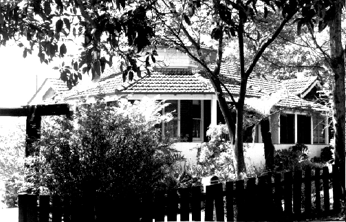
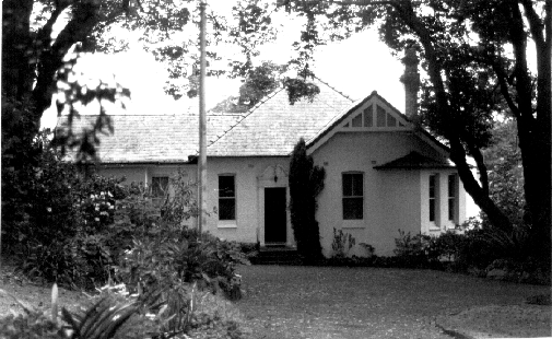

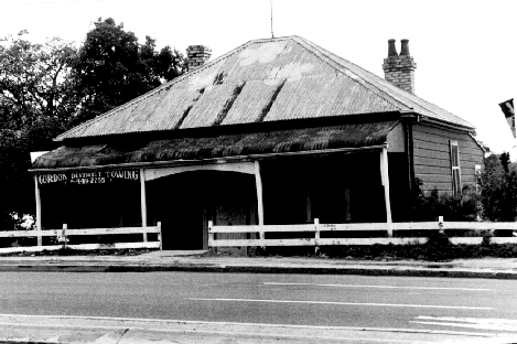


Grandview.jpg/220px-(1)Grandview.jpg)


No comments:
Post a Comment